NISYROS
Nisyros is one of the Dodecanese islands, located on the eastern side of the South Aegean. It is a cone that rises nearly 700 meters above sea level and signifies the island's identity: the youngest major active volcano in the Aegean.
The "volcano" is not only the popular tourist crater of Stefanos, which dominates the center of the island. The whole of Nisyros is a large volcanic structure. There is not a single stone on the island that does not owe its existence to volcanic activity, nor is there a layer of rock that was not deposited by one of the many volcanic eruptions that occurred here.
The great variety in the comsite and forms of the rocks that build the island, the extensive and easily accessible natural sections, and the wonderful climate throughout the year make Nisyros an outdoor geological museum.
Furthermore, Nisyros is the only active volcano in the Aegean with such low and high vegetation, hosting a rich fauna, from reptiles to predators. The crystal-clear blue waters allow for viewing a beautiful and rich underwater world, emphasizing the balance between marine and terrestrial environments. With continuous habitation since prehistoric times, it hosts an disproportionately high number of significant cultural monuments relative to its size.
It is a paradise not only for geologists but for any visitor who respects and loves nature, striving to learn from the eternal wisdom of its activity for their own infinitesimal moment of existence.
Here, initial general information is provided about the geology, rocks, nature, and culture of Nisyros. Then, the most interesting 11 routes of the island are briefly described, with a primary focus on the geology of the area.
For safe exploration, it is essential to have with you a map at a scale of 1:10,000 of the area, with the relevant routes, which you can obtain from the related folder on the website. On the same site, you can also obtain the routes in digital format for satellite navigation. Before starting any route, carefully read the related information and follow the instructions of the "Hiker's Code of Conduct," also found on the same website.
Some sections of the routes depicted and recommended here traverse non-public areas, mainly due to the unsuitability of parts of the old paths. Respect for property, entering and exiting without causing any damage to fences or cultivation, and informing the owner if present are required.
The History of the Volcanoes
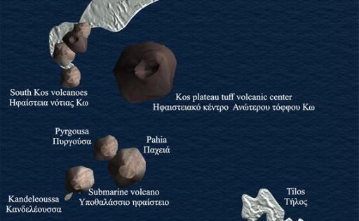
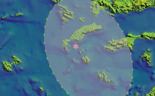
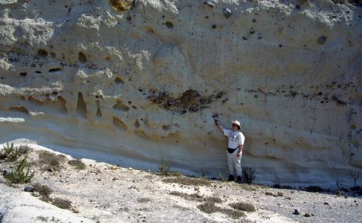
At the eastern end of the volcanic arc, volcanic activity began about 3.4 million years ago, adding new volcanic land to southern Kos and creating small islets south of it, such as Pyrgousa and Pachia. A massive eruption ends volcanic activity in Kos about 161,000 years ago. It is the largest eruption ever recorded in the eastern Mediterranean. It blasted hundreds of billions of tons of rock into the atmosphere, spreading as volcanic ash throughout the area, today covering half of Kos, and is also found in Kalymnos, Tilos, and the nearby coasts of Asia Minor. Images from the General Folder of Nisyros
After this event, eruptions continued to the south, constructing Nisyros, Stroggili, and Gyali. Nisyros is the youngest of Greece's major active volcanoes. The oldest rocks here are slightly less than 160,000 years old, while the youngest are up to 5,000 years old.
It is not known exactly when the submarine foundations of Nisyros began to form. It certainly took several tens of thousands of years of underwater volcanic activity before the island's first peak emerged from the Aegean waters, about 150,000 years ago.
Once the volcano emerged from the sea, it began building a terrestrial cone. Over the next 100,000 years, a large volcanic cone was built above sea level through the succession of ash and lava layers. Its diameter is estimated at about seven (7) kilometers, and its maximum height is 700 meters.(εικάνα Animated representation of the formation of Nisyros' first terrestrial cone.)
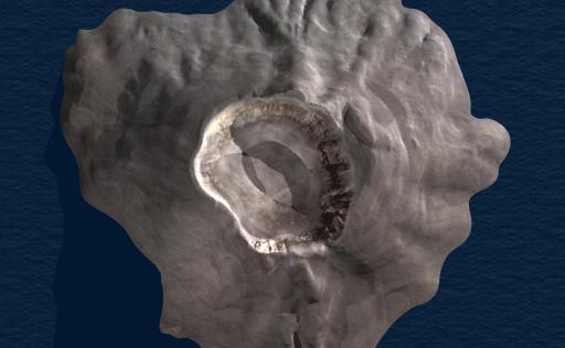
The first major catastrophic eruption occurred on the island about 55,000 years ago. Within a few days, billions of tons of molten rock were ejected into the atmosphere, creating a massive volume of pumice and ash. The volcano's summit collapsed into the void created beneath the island due to the magma's ejection, forming Nisyros' first caldera.(εικόνα The first terrestrial cone of the Nisyros volcano.)
Το ηφαίστειο, αφού αναδύεται από τη θάλασσα αρχίζει να οικοδομεί ένα χερσαίο κώνο. Στα επόμενα 100.000 χρόνια οικοδομείται από τη διαδοχή στρωμάτων τέφρας και λάβας ένας μεγάλος ηφαιστειακός κώνος πάνω από τη στάθμη της θάλασσας. Η διάμετρός του υπολογίζεται σε επτά (7) περίπου χιλιόμετρα και το μέγιστο ύψος του σε 700 μέτρα. (εικόνα Ο πρώτος χερσαίος κώνος του ηφαιστείου της Νισύρου)
Η πρώτη μεγάλη κατατροφική έκρηξη εκδηλώνεται στο νησί πριν περίπου 55.000 χρόνια. Μέσα σε λίγα εικοσιτετράωρα, δισεκατομμύρια τόνοι λιωμένο πέτρωμα εκτοξεύονται στην ατμόσφαιρα παράγοντας τεράστιο όγκο ελαφρόπετρας και στάχτης. Η κορυφή του ηφαιστείου κατακρημνίζεται στο κενό που έχει δημιουργηθεί κάτω από το νησί λόγω της εκτόξευσης του μάγματος και δημιουργείται η πρώτη καλδέρα της Νισύρου.(εικόνα Η πρώτη καλδέρα της Νισύρου, πριν 55.000 χρόνια)
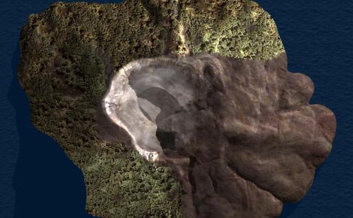
After this eruption, the viscous molten rock formed large lava domes near the eastern rim of the first caldera, covering the southeastern slopes of the volcano with very thick lava flows, on which the Nikia are now built. (image Nisyros' second caldera, 45,000 years ago.)
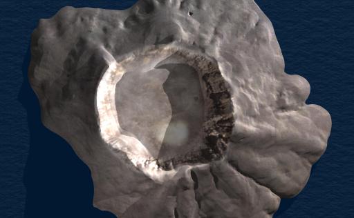
The period of calm that followed was interrupted by the second catastrophic eruption of Nisyros, about 45,000 years ago, which added new layers of pumice to the island and created the present-day caldera of Nisyros. (image The first terrestrial cone of the Nisyros volcano.)
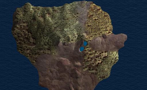
The magma, thousands of years after the eruption, emerged calmly, creating between 7,000 and 5,000 years ago the "post-caldera domes," the tall hills that fill about 2/3 of the caldera. Outside the caldera, it builds the Karavioti dome, and Nisyros takes its present form. (image Nisyros after the formation of its younger domes, 7,000 ~ 5,000 years ago.)
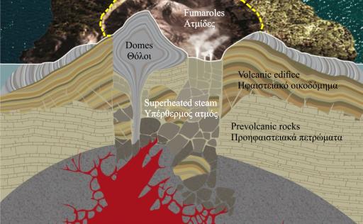
None of the subsequent eruptions recorded in historical sources produce molten rock. All are hydrothermal eruptions due to the presence of superheated steam in the island's underground. Sea and rainwater seep into the island's rocks, accumulate in deep horizons, and are heated by the magma. The water there turns into superheated steam, exerting tremendous pressures that, when they exceed the weight and cohesion of the overlying rocks, blast them into the air, causing a hydrothermal eruption. (image Schematic representation of the current state of the Nisyros volcano. )
Hydrothermal Explosions on Nisyros
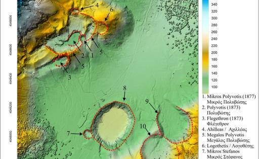
All the eruptions recorded on Nisyros during historical times have been hydrothermal. In the central and southern parts of the caldera floor, there are traces of 20 such craters. Ten of them are well-preserved, each with its own name. (image The Site and Age of the Hydrothermal Craters of Nisyros)
Myth
Even today, we do not know precisely when molten rock first began to erupt in the Nisyros area. However, the ancient Greeks had a clear idea both about the time and the manner of the island's creation: "Polybotis, chased by Poseidon across the sea, reaches Kos. But even there, Poseidon grabs a piece of the island and throws it on top of him. It is the islet called Nisyros." (image: Image of a classical vase depicting the battle between Poseidon and Polybotis, under the gaze of Mother Earth..)
This myth reveals that our ancestors knew Nisyros was a volcano and that its rocks were similar to those of southwestern Kos. They also knew or sensed that frequent local earthquakes were intertwined with the island's formation mechanism. The trapped energy of molten rock and superheated steam beneath Nisyros is transformed into the giant Polybotis, who groans and shakes, imprisoned in its depths.
Ένας μύθος που αποκαλύπτει ότι οι πρόγονοί μας γνώριζαν πως η Νίσυρος είναι ένα ηφαίστειο και ότι τα πετρώματά της είναι παρόμοια με αυτά της νοτιοδυτικής Κω. Γνώριζαν ή διαισθάνονταν επίσης ότι οι συχνοί τοπικοί σεισμοί είναι συνυφασμένοι με το μηχανισμό γένεσης του νησιού. Η εγκλωβισμένη ενέργεια του λιωμένου πετρώματος και του υπέρθερμου ατμού κάτω από τη Νίσυρο μετασωματώνεται στο γίγαντα Πολυβώτη, που στενάζει και τραντάζεται φυλακισμένος στα σπλάχνα της.
History - Culture
Nisyros has a long history. The island has recorded traces of Neolithic habitation from the 5th millennium BC, and life seems to have continued uninterrupted from then until today. The island flourished particularly in the 4th century BC and the 12th-13th centuries AD. By the end of the 19th century, it had about 5,000 inhabitants. From then on, it began a downward trend. Agricultural production, fishing, and livestock activities were no longer sufficient, so the residents turned to emigration.
The oldest findings of human presence in the wider area are from the Neolithic period, with remains of habitation on the islet of Gyali and in certain sites, mainly in northwestern Nisyros.
For the Minoan and Mycenaean presence, there are faint traces, with horn-shaped carvings, fragments of pottery, and "Cyclopean" walls from these civilizations (see Route 2).
The pre-classical and classical period (10th to 4th century BC) is represented mainly by the famous Palaiokastro, numerous sculptures and fragments of ancient temples, and the settlement in the Argos area (see Route 4).
From the Hellenistic period, some extensions and additions to classical buildings are preserved, as well as numerous "watchtowers" (fortified towers), both on Nisyros and on the islet of Pyrgousa, which is named after them (see Route 11).
The Roman period of habitation left behind sculptures and remains of baths and reservoirs, some of which are still visible outside Paloi (see Route 8).
During the early Byzantine years, many large and small churches were built, some of whose ruins are still preserved.
From the 11th to the 15th century, the Latins dominated, initially the Venetians and later the Knights Hospitaller, who built the eponymous Castle in Mandraki and numerous other fortification works (see Route 4).
After the fall of Constantinople, Nisyros fell prey to pirate and Turkish raids, becoming completely deserted by the end of the 15th century. In 1522, it was subjected to Turkish rule, which lasted until 1912 when it came under Italian occupation. The special status granted by the Ottomans to the Dodecanese, with strong and active local self-governance, allowed Nisyros to develop significantly during this period. Many churches from this period testify to relative prosperity and vibrant social life (see Routes 2 and 4).
Flora - Fauna
Nisyros is situated on the eastern migratory corridor for Asian bird species, the most important route in their journey to Greece and Asia Minor. Due to its fertile volcanic soil, the flora is highly developed.
The recorded presence of 450 plant species, 85 bird species, 7 species of reptiles, as well as the presence of the Mediterranean monk seal (Monachus-monachus) on the island’s shores highlight this island as a place worthy of special protection and study.
The dense shrubby vegetation provides a pleasant obstacle for hikers off the trails. Due to the many trees, Nisyros can be characterized as the only "green" active volcano in the Aegean.
The fauna is as diverse and varied as the flora on the island. Additionally, there are many free-range animals such as goats, pigs, and cows.
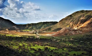

Geotrail 1
Geotrails
Distance:
5.95 km
Altitude:
94-311 m
Duration:
132 minutes
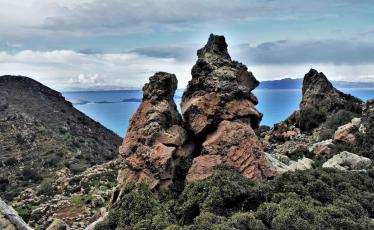

Geotrail 2
Geotrails
Distance:
8.57 km
Altitude:
186-684 m
Duration:
240 minutes
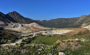

Geotrail 3
Geotrails
Distance:
9.48 km
Altitude:
11-354 m
Duration:
237 minutes
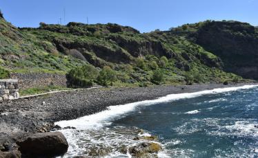

Geotrail 4
Geotrails
Distance:
5.6 km
Altitude:
0-194 m
Duration:
138 minutes
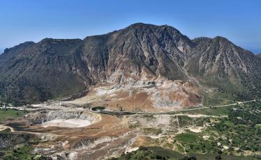

Geotrail 4
Geotrails
Distance:
6.63 km
Altitude:
395-448 m
Duration:
155 minutes
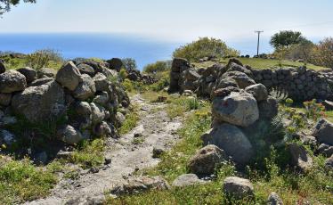

Geotrail 6
Geotrails
Distance:
5.79 km
Altitude:
14-405 m
Duration:
139 minutes
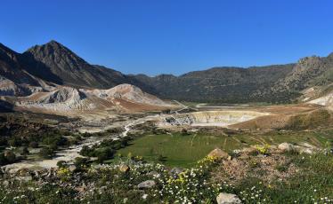

Geotrail 7
Geotrails
Distance:
1.56 km
Altitude:
40-203 m
Duration:
45 minutes
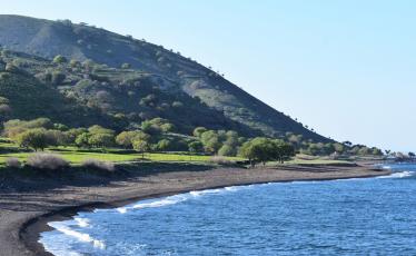

Geotrail 8
Geotrails
Distance:
8.05 km
Altitude:
4-105 m
Duration:
179 minutes
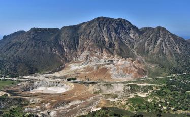

Geotrail 9
Geotrails
Distance:
3.18 km
Altitude:
248-364 m
Duration:
82 minutes
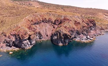

Georoute 10
Geotrails
Distance:
26.6 km
Altitude:
0-4 m
Duration:
82 minutes
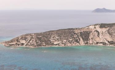

Geotrail 11
Geotrails
Distance:
43.39 km
Altitude:
0-11 m
Duration:
869 minutes


