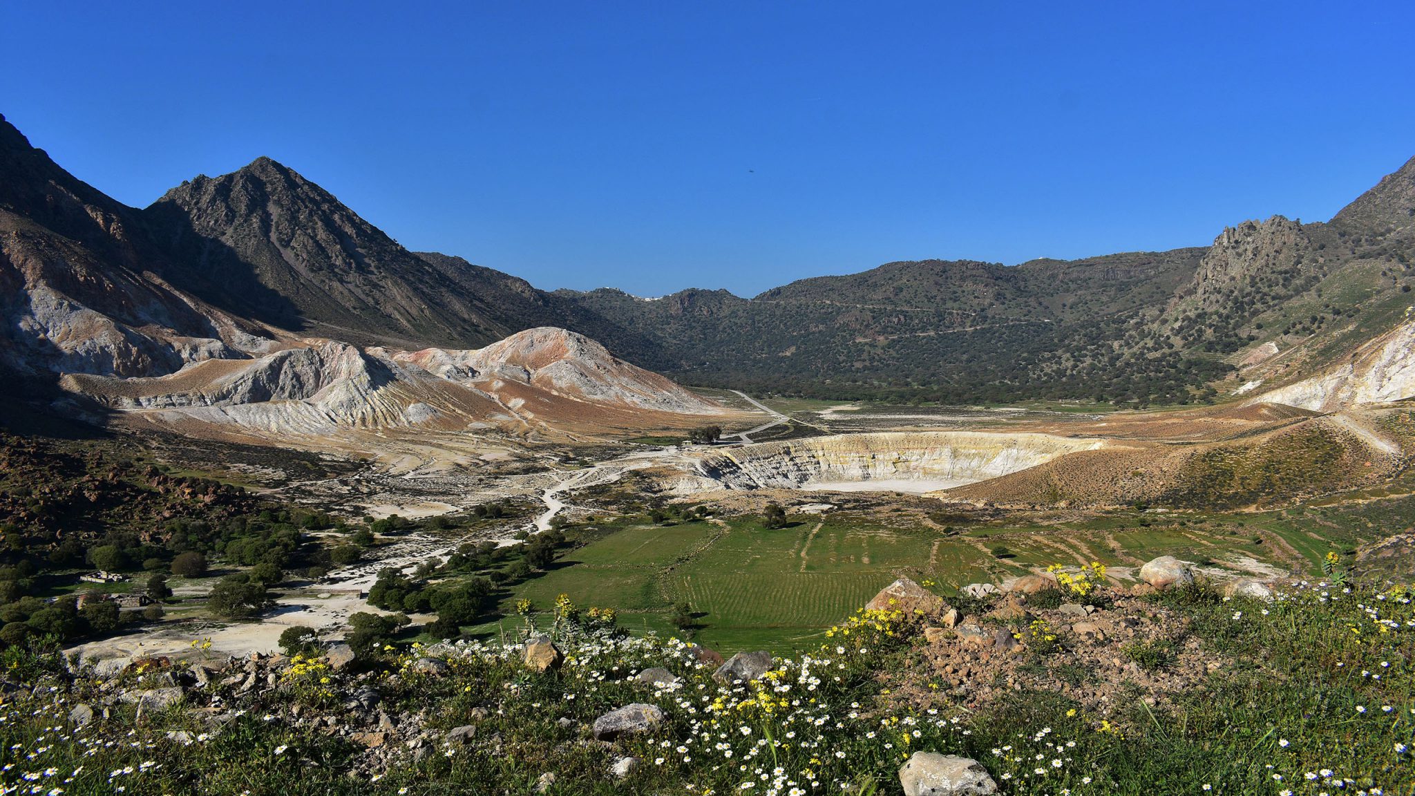
The route starts from the highway on the western slopes of Nisyros, at the junction of the Karaviótis dome with that of Trapezína. You can also reach this point on foot from Mandráki. The first site to visit is the "Siones" (site 3.1). A small church on the western slopes of the caldera, dedicated to the Nativity of the Theotokos (Panagia of Siones) with rich frescoes as it was renovated by the hieromonk Jonas in 1733. From here, you can observe a small lowland area, a remnant of the western part of the caldera's floor, and on the western slopes of the caldera, the layers of andesitic lava that form this part of the volcano. To the west is the Karaviótis dome, the only one that developed outside the calderic subsidence. On its outskirts is the church of St. Zacharias. If you decide to climb to the top of the dome, you will find a small withdrawal crater, similar to that of the Prophet Elias. Approximately 800 meters to the south, you leave the highway between the Karaviótis and Trapezína domes and enter right onto the path that mainly moves through the unexplored archaeological site of Argos. Observe the structures and lava flow spikes of the Karaviótis dome to the west.
Follow the path along the valley, and when you reach the beach of the White Bay, you can locate a warm spring at the western end with a temperature of 57°C (site 3.2 moved and changed name). On the slopes of Argos, you will encounter numerous remains of habitation from the Neolithic (?) period to the previous century, with the most interesting being the remains from the classical period (site 3.3). Particularly impressive are the "terraces" (terracing for cultivation) of the area, with their high retaining walls constructed exclusively from the remnants of andesite quarrying for the production of the famous "millstones" (grinding stones) of Nisyros. The last part of the path moves through impressive displays of andesitic lava flows and red scoria (site 3.4). This area hosts tunnels, dug into the ground (site 3.5), extending for tens of meters and a few meters deep. They are most likely shelters constructed by the island's inhabitants from ancient times to hide from potential conquerors, pirates, and other unwanted visitors. The path ends at Agia Irini, where remnants of the sulfur processing plant built here in 1879 by A. Rallis and operated for only 10 years are preserved (site 3.6).
There is a path from the White Bay leading to Drakospilo, the southernmost watchtower (sea monitoring station) of Nisyros (site 3.7). There, under the collapsed walls of the watchtower, the cave that likely served as a residence for the guards is preserved. The route is particularly difficult in its final section, as it moves over the sharp fragmented lavas of Karaviótis, and there is no marked path here. Returning from Agia Irini towards the Monastery of the Cross, about halfway along the dirt road, the path begins that leads to Pyria (site 3.8), an area of steam emissions, which has been used since antiquity as a place for inhalation therapy and natural sauna. Along the route, there are very good displays of the Lower Kisses formation: fall horizons and pyroclastic flow of kisses, from the island's first catastrophic eruption. For mineral collectors, the area is suitable for collecting beautiful skarn specimens. The route ends at the Monastery of the Cross (site 3.9), built on the southern rim of the caldera. Here stood one of the five castles of the Knights Hospitaller of Rhodes, but only a few barely distinguishable remains survive. From this site, there is an excellent view of the hydrothermal craters and andesitic scoria and lava flows of the southern caldera slopes, as well as the Trapezína dome.

