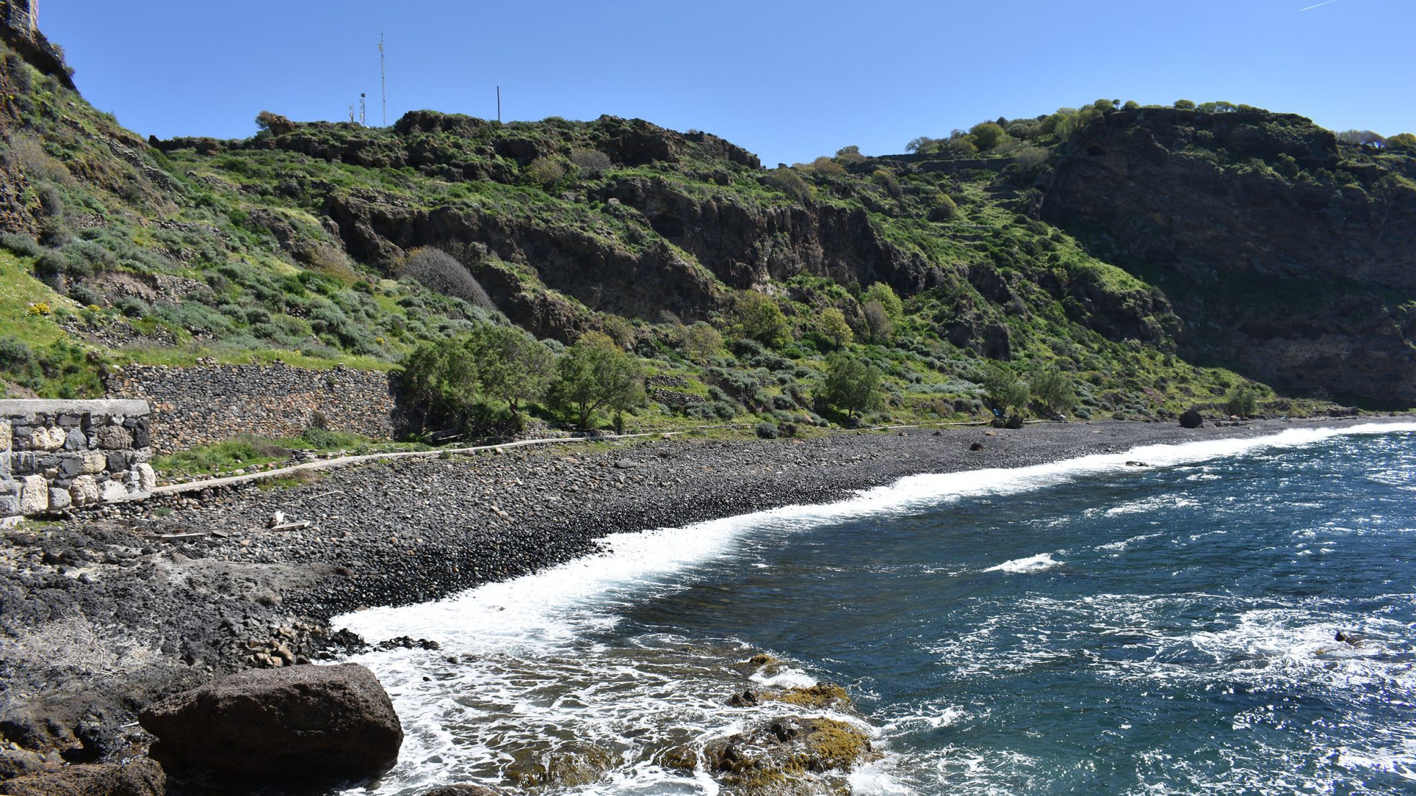
The route starts from Mandraki, from the Tavla tou Gialou, beneath the cliffs where Panagia Spilianni is perched (site 4.1). There, you can observe the older lava flows of the volcano, its underwater foundations: Dozens of “pillows” of gray basaltic andesite with diameters ranging from half a meter to ten meters are visible from here and extend to the Chochlakoi bay, the “beach” of Mandraki, a beach with impressive black pebbles, the product of marine erosion of the underwater lava flows. The majority of the deposits here are layers of glassy fragments: lava pillow breccia.
Continue along the coast towards the Kanoni cape. By balancing for a while on large boulders of basaltic andesite lava – the same material used to build the Paleokastro, which is now on top of the steep cliff above your head – you will reach the second steep valley. Here, a small climb will reveal layers of old pebbles and sand, those left by the sea on the lava flows when they were beneath its surface (site 4.2). Among these layers, you will see a whitish sand that shines oddly in the sun. Don’t be deceived into touching it. Your hands will be covered with tiny spines – similar to those of prickly pears. These are millions of tiny silicon needles, the skeletons of sponges that lived in the sea of that time. Altogether, these are the deposits of the gravelly breccia of the Castle, layers indicating that the area was recently beneath the sea's surface.
Next, you can “climb” (a climb of slight difficulty due to the presence of ledges and an unmarked trail) across the slope. To your upper right, the faces of the old andesitic lava flows will dominate (site 4.3). When you reach near the Helicopter Pad, you can take the beautiful trail to Kanoni, the western cape of the island (site 4.4). There, impressive faces of andesitic lava and columnar jointing structures of the lava flows are dominant. From Kanoni, continue east on a poorly marked trail, walking over the mudflows covering the ash of the Lower Kisseira of Nisyros, the first major catastrophic eruption of the volcano.
From here, you can either take the return trail to the north or move towards the road and visit the church of Panagia Faneromeni (site 4.5), a cross-shaped church with a dome. In the sanctuary, you can see remnants of fine art frescoes, likely from the 14th-15th centuries, while numerous scattered marble fragments testify to the prior existence of an ancient temple on the same site. In the surrounding area, there are also other ruined temples and stone buildings that likely served as monk residences.
The return road leads left to Paleokastro and right to Mandraki. From here, the trail to Mandraki begins. If you haven’t visited Paleokastro (site 4.6), it is a must-see. It is an extremely luxurious fortification from classical times. Two long vertical walls made of black basaltic andesite, extending north and west, have been preserved. These walls are three to five meters thick. The bastion towers are square, approximately 25 meters apart from each other, and project out from the walls. On the first tower, north of the main gate, there is an engraved inscription stating that the land five feet wide along the wall belongs to the public: “DAMOSION TO CHORION PENTE PODAS APO TOU TEICHOS.”
Inside the walls, there are stairs of 15-20 steps leading to the battlements. Both the inner and outer walls are built with the same meticulousness. These enormous squared boulders fit perfectly together. The space between the two walls is filled with gravel and soil and covered by large stone slabs. Inside Paleokastro, one can also see several sections of the masonry of a very large early Christian basilica as well as several marble fragments with exceptional artistic details. Inside the area, besides the classical, Hellenistic, and Byzantine remains, you will find the quarries for extracting the andesite used in its construction (site 4.7).

