MILOS
The islands of Milos, Kimolos, Polyaios and the rocky islets of Ananes are almost entirelycomposed of volcanic products.
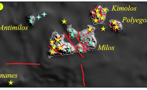
Volcanic activity begins in the area about 3.6 million years ago in the area of Milos and Kimolos, and continues until historical times ( 4th century AD) with hydrothermal eruptions in south-eastern Milos. Thus the Milos volcanic field is created. Here any large central volcano structure is absent. Only Antimilos can be considered a small central volcano. Milos, Kimolos and Polyaigos are created by several small volcanic centres, mainly scattered lava domes, which are then unified as a geographical area by the ash deposits of large eruptions. (image The volcanic field of Milos. Stars: terrestrial volcanic centres; Crosses: submarine volcaniccentres; Open stars: craters of hydrothermal eruptions. Yellow: 1,800,000 years old, Cyan:1,800,000 years, Red:10,000 years. Red lines: main faults.)
From 3.6 to 1.6 million years ago (Ma), ejecta and eruptive action creates Chimolos, Polyaigos, and most of Milos. Almost all of this period Milos is below sea level, while Cimolos was landlocked about 3 million years ago.
After 1.6 Ma, volcanic activity is restricted to central Milos and Antimilos is formed.
During this period we distinguish three periods in central Milos:
1. Between 1.1-0.9 Ma a large field of rhyolitic lava flows is deposited.
2. Around 0.38 Ma before 0.38 Ma, the Trachila rhyolitic tophoon cone and its associated lava flows are built.
3. The last volcanic eruption occurs 110,000 ~ 60,000 years ago in Milos, creating the tophi ring and lava flows of Fyriplaka.
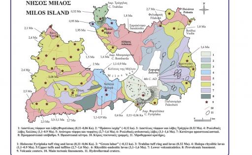
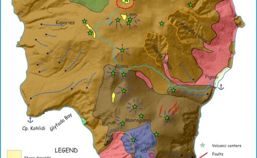
The comsite of the magma feeding the volcanic activity in the area ranges from basaltic andesite to rhyolite, with the latter dominating. (image Simplified geological map of Milos.)
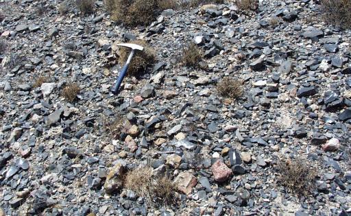
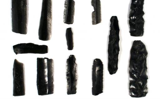
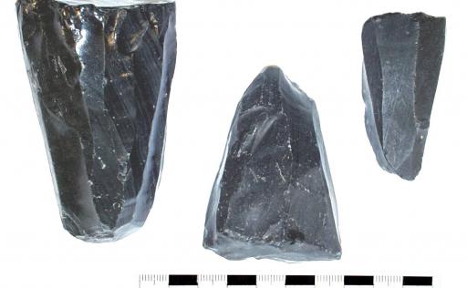
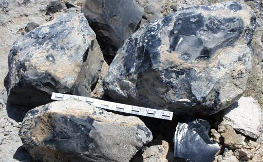
This volcanic activity is particularly important for the man of the eastern Mediterranean, since, about a million years ago, it creates in two places (Bobarda and Demenegaki) the deposits of the famous obsidian of Milos. Obsidian is a volcanic rock consisting of black solid natural glass, a very hard and beautiful rock. Its main advantages are its great hardness and the ability to extract, with a few deft strokes, fine blades as sharp as a scalpel. The volcanoes of Cappadocia, Milos and Lipari in the Aeolian Islands were the three main sources of obsidian that came to light in all excavations of Neolithic sites and settlements in the Mediterranean, for over 15,000 years ago. During the Neolithic period, Milos became a centre for the production, processing and distribution of the precious obsidian. The settlement was built in the ( image Occurrences of obsidian, raw and worked cores, tools, blades, Neolithic debris. )
About 1 million years ago, mainly in the area of central and eastern Milos, a large high enthalpy geothermal field was established, which today hosts fluids of 330 oC at depths of one kilometre. This fuels numerous hydrothermal eruptions in the area. The first distinct period of hydrothermal eruptions is located about 0.12 Ma ago. This period sees the formation of the huge hydrothermal craters of eastern Milos. From these eruptions the 'green lahar' formation, which covers most of eastern Milos, is deposited. These are horizons of superimposed mudflows whose components are exclusively, or for the most part, shale fragments. The interpretation of the genesis and desite of this geological formation, which is probably unique in the world, is at the centre of discussions among the world's volcanologists, the most important of which is the one given above.
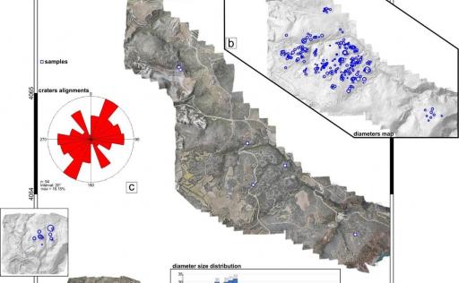
The most recent period of hydrothermal eruptions occurred in the 4th century AD, in a zone starting from the areas of Agia Kyriaki - Paleochori - Thiochoria and extending several kilometres north-west. This period coincides with the period when archaeological finds are absent in Milos, and it is thought that it is probably linked to the abandonment of the island due to these explosive episodes. (image Site, layout and size of historical hydrothermal craters in eastern Milos.)
The island of Antimilos (or Eremomilos) is the only complex volcanic edifice in the region, structured by alternating domes and lava flows, with few intermediate eruptive episodes. The onset of terrestrial activity of the edifice is estimated at 0.3 Ma, while the last volcanic activity (Agriokastro lava dome) is estimated from its morphology as a very recent event, probably a few thousand years old. (image Schematic geological map of Antimelos).
Hot magmatic fluids and underground water heated by volcanoes circulate deep in the cracks of the rocks of Milos and deposit precious metals such as gold and silver, iron and manganese ores, semi-precious stones such as amethyst. The intense circulation of hot fluids in the volcanic rocks of the area, which are eroded and transformed in places into rich deposits of industrial minerals such as silicate, kaolin and bentonite.
Thus Milos, Kimolos and Polyeagos, together with the rich deposits of sulphur and perlite - pumice, are transformed into a kingdom of industrial minerals. The intensive exploitation of these deposits, especially in the last 60 years, has shaped the current landscape of Milos.
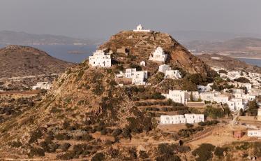

Geotrail 1
Geotrails
Distance:
24.2 km
Altitude:
1-154 m.
Duration:
543 minutes
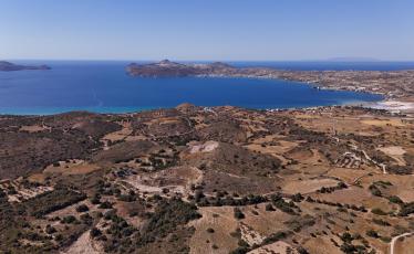

Geotrail 2
Geotrails
Distance:
26.24 km
Altitude:
5-148 m.
Duration:
612 minutes
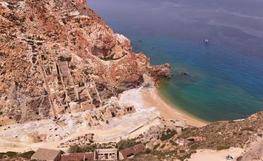

Geotrail 3
Geotrails
Distance:
8.87 km
Altitude:
13-213 m
Duration:
210 minutes
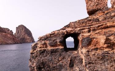

Geotrail 4
Geotrails
Distance:
19.31 km
Altitude:
51-224 m
Duration:
456 minutes
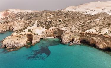

Geotrail 5
Geotrails
Distance:
77.74 km
Altitude:
0-10 m
Duration:
1558 minutes
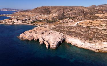

Geotrail 6
Geotrails
Distance:
25.43 km
Altitude:
0-224 m
Duration:
580 minutes


